
Owasco Lake
Tuesday, May 11, 2010
Since this was the off-season, parking was free in the lot at Emerson Park, site of the Merry-Go-Round Playhouse. I had planned my route after a drive around the lake, noting the location of stores to replace my food and water supply. This became my standard procedure, reducing the weight I had to carry on the longer walks.
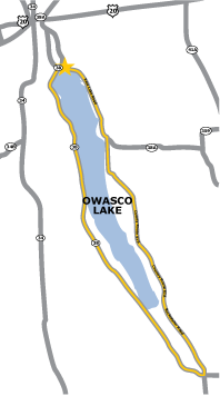
Street names in the Finger Lakes show a remarkable lack of imagination but are informative. East and West Lake Roads are ubiquitous in the region. Thus, I began on Route 38, West Lake Road, which hugs the lake at the northern end, veers away, and returns at the southern end. The spring runoff had created several nice waterfalls, a beautiful addition to the scenery.
The southern tip of the lake is a swampy area, so I had to follow three or four miles of road to Moravia where I was able to buy snacks and water at a Mobil station. Fortified by this break, I picked up County Route 61A, Rockefeller Road, to proceed north.
Route 38A, predictably named East Lake Road, was my route to return to Emerson Park. I had a brief scare when a truck fire caused a roadblock near the end of my walk. Fortunately, I was able to cut through neighborhood front yards and finish.
Tom Thumb’s Restaurant was a great place to enjoy views of the lake while enjoying an ice cream cone. The owner also has a couple of artistic oddities: a replica of a romantic Italian sculpture and a photo of Sarah Palin taken during her visit to Auburn. Check out the slide show to see a photo of the sculpture.
Owasco was one of my favorite walks. Though hilly, it was not overly demanding, and offered wonderful views and perfect weather conditions with a high temperature of fifty-six degrees. I completed the thirty-three miles in about nine and a half hours.