
Conesus Lake
Friday, October 22, 2010
For this final walk, my son Zach joined me as he had for Skaneateles Lake early in July. His feet were healed, and he wanted to share this last lake journey and celebrate my accomplishments.
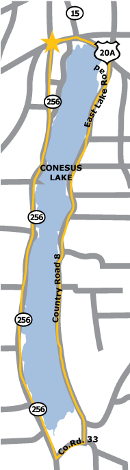
We were awake at four in the morning to make the two-hour drive to the northern end of the lake where we parked in a restaurant lot at the junction of Routes 256 and 20A.
It had been raining when we left Syracuse, but the rain stopped before we started walking, though the temperature never went over forty-seven degrees, and the lake winds were brisk. As we walked south on West Lake Road, we were glad for our hats and gloves protection against the chill. Turning off West Lake to Slicker Hill Road, we were close to the shore as we went north on East Lake Road.
The route around Conesus is mostly flat with many homes and camps lining its shores. From Route 20A, we walked into the village of Lakeville for a festive lunch. Zach is a true man of his times, so he commemorated our walk with a Facebook post announcing that I had completed “Walking the Finger Lakes.”