
Keuka Lake
Saturday, September 18, 2010
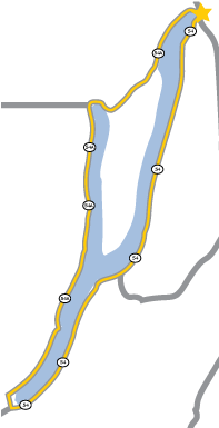
For several reasons, this was a particularly unusual walk. First, I attempted it on a weekend. Next, Keuka is sometimes called “The Broken Finger” because of its y-shaped shoreline, so I didn’t even try to follow its irregular form. Instead, I settled for a walk that cut across its two northern points. Finally, this was my only real encounter with a biting dog, though he may have just been a playful nipper. At any rate, no blood was shed during this venture.
As summer waned and the days grew shorter, I began my drive west from Syracuse in the complete darkness of early morning. After parking at the Penn Yan Aldi store, I began walking at five thirty, barely able to see the road after leaving the lighted village streets and turning south on Route 54A. Fortunately, the road had recently been repaved with soft and smooth asphalt, my preferred walking surface. I was cautious as cars approached, crossing to the opposite side of the road to decrease the chance of a driver failing to see the lone unexpected pedestrian.
Route 54A turns away from the northeast fork of the lake to Branchport at the northwestern tip. South of Branchport, 54A is known as—you guessed it—West Lake Road. The road and lakeside along this side are lined with residences and camps, but are also fairly level and easy to navigate.
As I walked, I heard the sound of a seaplane repeatedly taking off and landing. I figured that a new pilot was practicing these skills. Later, I found out that Hammonsport was hosting its annual seaplane festival, a gathering of flying enthusiasts.
After lunch in Hammondsport, I returned to Route 54A and north on Route 54, East Lake Road, all the way back to Penn Yan. It had been a forty-five mile walk lasting about thirteen hours with a sunny high temperature of seventy-three degrees.