
Canadice Lake
September 27, 2010
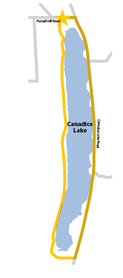
Nineteen miles around Honeoye left me a few hours of daylight, so I took advantage of the proximity to Canadice Lake and drove west to complete another lake circuit. In my examination of Google maps of the area, there appeared to be a road right along the western shore. If I were mistaken, I’d need to go much further west to find a route. Luckily, after parking right off Purcell Road, I passed a barricade that blocked vehicle traffic onto an access road that continued down the western shore to the southern tip of the lake.
Canadice is a protected watershed for the city of Rochester and has no buildings on its shoreline. Swimming is also prohibited, though canoes and kayaks are permitted. The western shore is quite pretty and peaceful, but if you plan to explore during the summer, bring a mountain bike and bug spray. There are drainpipes to direct the runoff from waterfalls and streams under the path and into the lake. Eventually, the isolated access road runs into Canadice Lake Road which leads north back to the parking lot at Purcell Road.
My second walk that day was nine miles, completed in two and a half hours in a continuing rain.